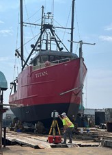
In 2024 and 2025, with funding from the Maine Department of Energy Resources and the Research Consortium for Offshore Wind, MCMI hired and outfitted an offshore-capable vessel (the F/V Titan) for multi-day survey operations in the Gulf of Maine. To staff the research vessel, MCMI hired and trained contractors on the technical elements of sonar operations and on visual survey methodologies for wildlife observations. Additionally, Biodiversity Research Institute (BRI) installed a passive acoustic bat sensor on the offshore survey vessel to listen for bats during nighttime survey efforts. The purpose of the 2024-2025 offshore mapping survey was to collect high-resolution bathymetry and acoustic backscatter in the Maine Research Array floating offshore wind lease area and along potential power export cable routes to shore, and to fill data gaps between and adjacent to prior bathymetric surveys. Data collected during the offshore mapping survey supports ongoing and future oceanographic surveys, habitat assessments, resource management, and marine development planning.
In 2024, the F/V Titan completed eight multi-day trips between August 1st and October 23rd, each trip ranging in length between 3 and 7 days. During mapping surveys, the DMR crew conducted 24-hour sonar operations and collected daylight-hour wildlife observations. The mapping was tremendously efficient, adding a total of 337 nmi2 new bathymetric coverage in 34 days of mapping. This required driving 2,001 linear survey miles and collecting 89 miles of crosslines to support quality control and final data processing. MCMI’s mapping efforts made great contributions to regional bathymetric and backscatter coverage and have been incorporated into updated habitat maps that connect inshore to offshore areas.
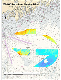
miles in 34 days.
After processing, QA/QC, and statistical validation, MCMI’s mapping data and hydrographic descriptive report were provided to the National Oceanic and Atmospheric Administration (NOAA) to make important updates to navigational charts, and the data are available at NOAA’s National Centers for Environmental Information (NCEI) Bathymetric Data Viewer. MCMI’s offshore survey data have been incorporated into NOAA’s high-resolution BlueTopo bathymetry product. Survey extents were uploaded to NOAA’s U.S. Mapping Coordination website to aid in ongoing seafloor mapping prioritization efforts. Statistically validated final bathymetric surfaces have also been published to the webmap of our bathymetric survey data on the DMR website..
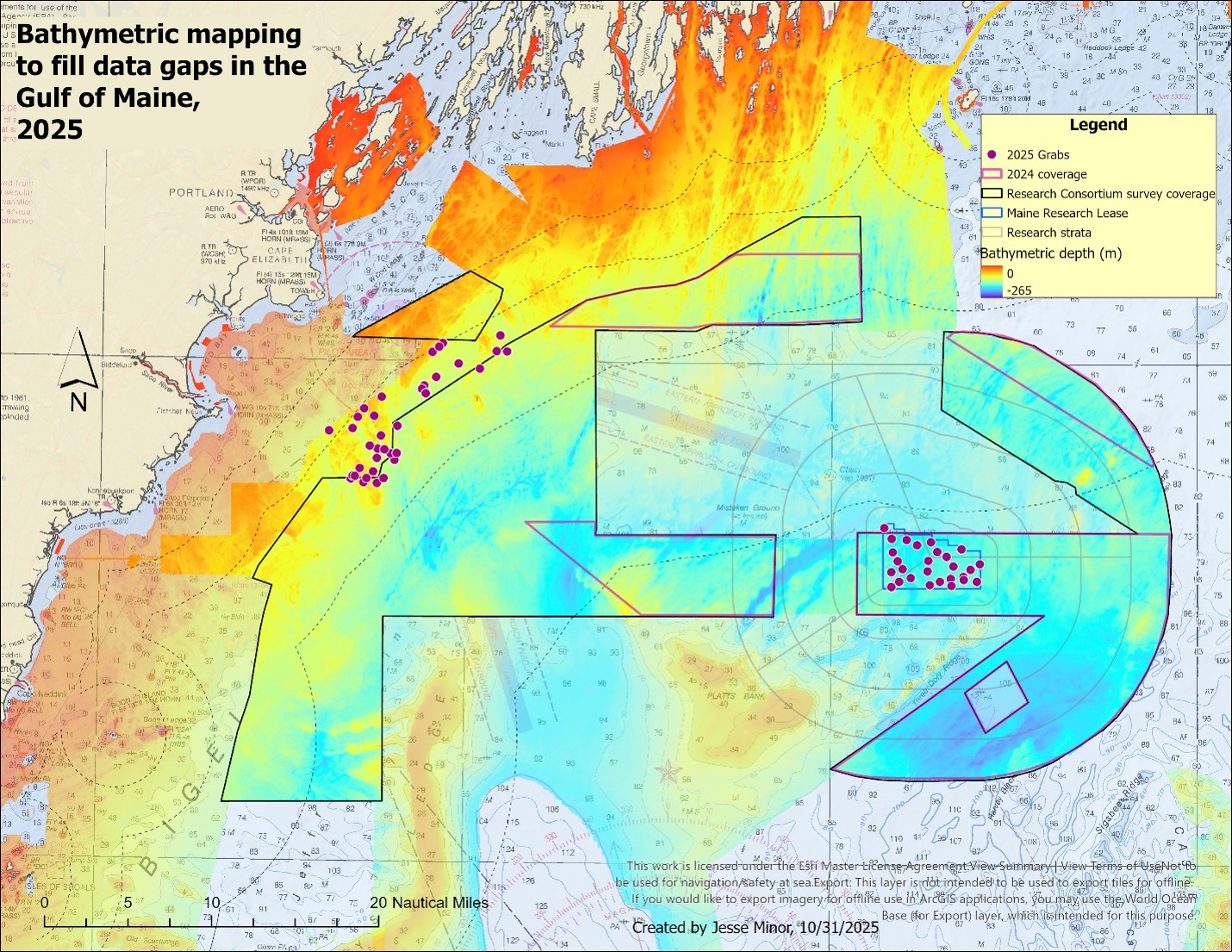
In 2025, the F/V Titan completed thirteen multi-day trips between July 16th and November 15th, each trip ranging between 2 and 5 days. Drawing on lessons learned in 2024, we staffed the offshore survey with a team of three contracted sonar operator/wildlife observers for multi-day 24-hour operations. Newly mapped areas totaled 439 nmi2 new bathymetric coverage in 46 days at sea. Including the area of crosslines and junction surfaces, the 2025 survey covered 591 nmi2 of seafloor. The 2025 survey filled large data gaps and created a very large contiguous area of high-resolution bathymetry collected by Maine DMR, NOAA and its contractors, and UNH.
Wildlife observations collected on the F/V Titan were important for understanding the use of these offshore areas by marine mammals and seabirds. In 2024, MCMI’s observers recorded a total of 314 marine mammals, including 18 unidentified whales, 87 unidentified dolphins, 84 Common Dolphins, 29 Long Finned Pilot Whale, 1 Humpback Whale, 1 Harbor Seal, 11 Bottlenose Dolphins, and 83 Atlantic White Sided dolphins. MCMI’s wildlife observers also counted 2,771 seabirds representing 26 species. BRI’s bat detector recorded 89 bats during the survey season. In 2025, MCMI’s observers recorded a total of 83 marine mammals, including 16 unidentified whales, 7 unidentified dolphins, 40 Common Dolphins, 2 Short-Finned Pilot Whales, 7 Fin Whales, 4 Harbor Porpoises, 1 Harbor Seal, and 6 Gray Seals. MCMI’s wildlife observers also counted 1,840 seabirds representing 29 species. BRI’s bat detector was operational during the 2025 season but the results have not been reported to DMR.

observing wildlife aboard the F/V Titan
Wildlife observations of seabirds, marine mammals, and highly migratory species collected during the 2024-2025 offshore mapping survey were reviewed for accuracy and compiled with MCMI’s 2015-2023 wildlife observations. The 11-year dataset containing the 2024-2025 Research Consortium-funded wildlife observations was sent to Duke University’s OBIS-SEAMAP world data center for marine mammal, seabird, sea turtle, shark & ray distributions project for inclusion into the marine wildlife catalog.

observing wildlife aboard the F/V Titan

collects sonar data at night on the F/V Titan