While recent efforts have provided a great deal of marine habitat data along Maine's coast, there are still notable gaps for over two-thirds of Maine's coast with respect to basic information needed for well-informed and forward-looking ocean and coastal resource management. Critical ocean data gaps include bathymetry, habitat, water quality parameters, water column temperature profiles, and benthic species composition. This type of information is critical to the understanding of emerging issues and the development of science-based measures to address them.
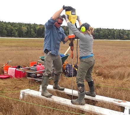
As the foundation of the Maine Salt Marsh Monitoring Network, the Maine Coastal Program and our partners have established dozens of long-term monitoring stations. Salt marshes provide coastal communities with storm and flood protection, fish and wildlife habitat, recreational and commercial harvesting opportunities, and pollutant filtration. They also store carbon that would otherwise contribute to climate change, including accelerated sea level rise. Salt marshes are especially sensitive to changes in water levels because they occupy such a narrow elevation band in the space between high and low tide.
