Home → Water Quality → Monitoring → Rivers and Streams → Volunteer River Monitoring Program
Volunteer River Monitoring 
Program (VRMP)
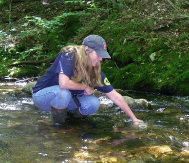
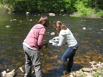
The Maine Volunteer River Monitoring Program (VRMP) was established to enable local, volunteer-led groups to conduct water quality monitoring of rivers and streams in Maine. The VRMP provides technical resources through equipment loans and training, a standardized monitoring approach to follow, and data archiving.
Learn more about the VRMP, participating groups and organizations, and water quality data from the Maine VRMP Story Map.
Program Contact
Kristin Feindel (Program Coordinator) - (207) 215-3461
Volunteer River Monitoring Program
Maine DEP
17 State House Station
Augusta, ME 04333-0017
VRMP Data
- VRMP Annual Data Summaries - by Group (2020 to present) – Summary graphs of data collected by VRMP groups. The graphs are organized by VRMP group and show the annual average and maximum values of monitoring parameters at different sampling sites across multiple years.
- VRMP Data Dashboard (2024 to present) – Recent data collected by VRMP groups. Map of sites, graphs of results and data by site. Can filter by year, organization, and other attributes.
- VRMP Data Dashboard (2019-2023) – Data collected by VRMP groups from 2019-2023. Map of sites, graphs of results and data by site. Can filter by year, organization, and other attributes.
- VRMP Annual Data Reports (2013 - 2020) – Summary of program information, parameters collected, sampling locations and results for each organization by sample year, beginning in 2013.
VRMP Monitoring Guidance Documents
- VRMP Quality Assurance Project Plan (QAPP) (PDF)
- VRMP QAPP Appendices (PDF)
- VRMP QAPP Standard Operating Procedures (SOPs) (PDF)
- Stream Survey Manual
Current Volunteer GroupsClick the links below to learn about each volunteer group's water quality monitoring through the VRMP.
Contact your local volunteer group to get involved. Field sampling is generally June-September. |
Androscoggin River Watershed Council
Upper Androscoggin and Tributaries
Contact: Ferg Lea
Biddeford Conservation Commission
West Brook, Swan Pond Brook, Thatcher Brook, Tributaries to the Saco River
Contact: Erik Heumiller
Friends of Merrymeeting Bay
Lower Androscoggin River, Lower Kennebec River, Merrymeeting Bay
Contact: Ed Friedman
Hallowell Conservation Commission
Vaughan Brook
Contact: Rosemary Presnar
Midcoast Conservancy
Sheepscot River and Tributaries
Contact: Melissa Cote
Mousam and Kennebunk Rivers Alliance
Kennebunk and Mousam Rivers and Tributaries
Contact: Betsy Smith
Northeast Creek Monitoring
Northeast Creek, Bar Harbor
Contact: Hailey Bondy
Presumpscot Regional Land Trust
Presumpscot River and Tributaries, Stroudwater River
Contact: Toby Jacobs
Rockport Conservation Commission
Rockport Harbor and Tributaries
Contact: Bill Bow
Scarborough Land Trust(previously Friends of Scarborough Marsh)
Scarborough Marsh Tributaries
Contact: Therese Lamperty
Skowhegan Conservation Commission
Currier Brook and Whitten Brook
Contact: Tristan Hinkle
Weskeag River Monitoring Project
Weskeag River and Tributaries
Contact: Theo Pratt
Other Data and Resources
- Maine Department of Environmental Protection
Maps and Data Page - A wide array of data types available from MDEP.
Rivers & Streams - Biomonitoring Maps and Data
- Gulf of Maine and its watershed
Knowledge Base. (off-site) Catalog of datasets and documents for the Gulf of Maine.
- U. S. Geological Survey (Maine region)
U.S. Geological Survey (Maine region) - The Maine water science center-including flow data.
- US EPA- Office of Water
- River Network
- Adopt-A-Stream Foundation
- Izaak Walton League: Save Our Streams Program