Home → Maine Bird Atlas → Submit Data → eBird Data Entry User Guide
eBird Data Entry - User Guide
You do not need a smartphone to enter your atlas data into eBird, although entering data that way can be very effective in areas both with and without cell phone coverage. You can record your data in the field on paper forms or in your notebook, then enter data into eBird later on a computer at home or at the library. Don't rely on your memory alone to collect data. Write your observations down on Field Forms or in your notebook as you see them. We encourage all observers to submit their bird records through the Maine Bird Atlas eBird portal or the Maine eBird portal. (Find out which Bird Atlas portal you should use to submit your observations.) The Maine Bird Atlas eBird portal is the only input that provides Atlas Block boundaries on the map and prompts you for entering all information required for the atlas. Create an entry for all field survey time even if no birds were observed.
Entering data in eBird
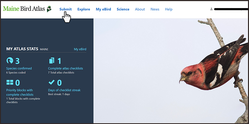
After selecting the "Submit" tab and signing in, you will be at the "Where did you bird?" screen.
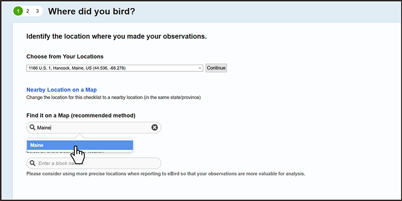
Use the "Find it on a Map" option to locate where you made your observations. Type "Maine" into the box, then click on "Maine, United States (US)" that appears underneath, and you will be shown a map of Maine.
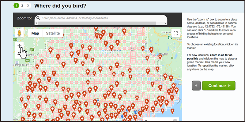
Use the zoom tools ("+" and "-" buttons in upper left) to zoom in on the map and you can drag the map to pan to the exact location that you surveyed or observed breeding birds. Zoom in as far as possible when plotting your observation point to prevent location errors. The buttons on the upper left of the map allow you to switch between satellite imagery, plain maps, and topo maps.
You can ignore all the red pins that appear on the map. You may also see blue pins marking existing locations you already have. You can use one of these existing blue pins (by clicking on it) if it accurately represents your birding location. We do not suggest using birding hotspots (the red pins) to report your atlas observations as often these hotspots refer to larger areas that cross Block lines or are near Block edges and may not be a good representation of where you birded.
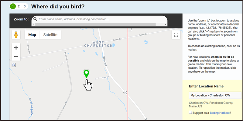
To set up a new location on the map, click on the map to plot the midpoint or center of the area that your species list represents. You should enter a name for this location where it says "Enter Location Name". It really doesn't matter what you call it, but we suggest including the Atlas Block name in your location name. Note that after you enter a location once, the location name will be available later from the "Choose From Your Locations" dropdown list.
You can select an entire Atlas Block as your location (Blocks are approximately 9 square miles), but these less precise locations are not as useful for analysis, so we recommend using the Block-wide point for data entry only in rare instances when you were not exactly sure where you were in the Block, for the odd incidental observation, or when you want the exact location to remain private.
Hit the "Continue" button to go to the "Date and Effort" page.
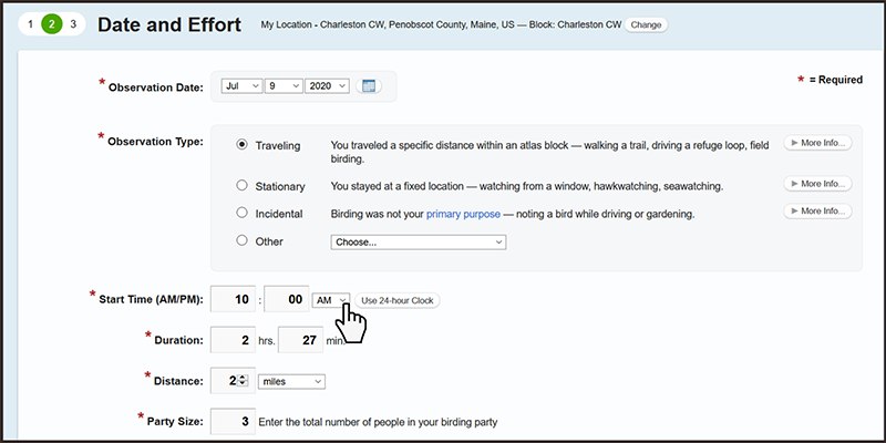
On the "Date and Effort" page, choose the observation date from the pulldown menu. For "Observation Type" most atlas volunteers working in their Block will select "Traveling", but you should select the type of observation that best describes your checklist. Enter the start time of your survey and make sure to choose AM or PM or use the 24-hour clock. Currently the eBird system flags a checklist as nocturnal if the survey starts more than 40 minutes before sunrise or more than 20 minutes after sunset, so please make separate checklists for nighttime and daytime observations.
Do your best to estimate and fill in the distance traveled, if applicable. Note that the distance traveled is the one-way distance. Do not count the distance you backtrack along the same track.
Hit the "Continue" button to go to the "What did you See or Hear?" page.
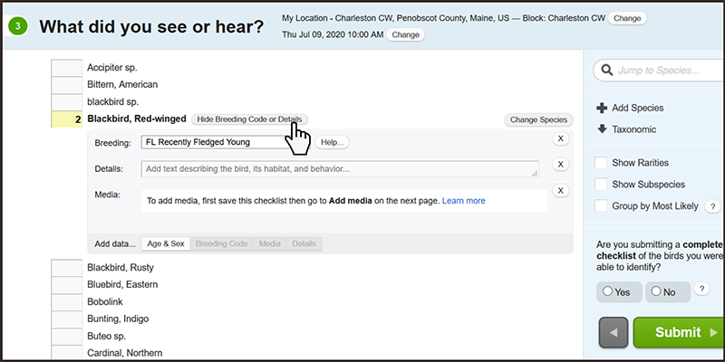
On the "What did you see or hear?" page, enter the number of individuals you observed for each species you confidently identified. It is fine to give a rough estimate for the number of individuals seen or heard. For those species for which you observed breeding behavior of any type, click the "Show Breeding Code" button and choose the best possible code for your observation. If more than one code is applicable, choose the highest possible code that you observed. We recommend filling in breeding codes for all birds observed on each visit, although it is not essential for species that have already been documented as a confirmed breeder in the Block. Once you have all of your records entered, click the "Submit" button in the lower right hand corner of the screen.