
Flood hazard mapping is central to the Floodplain Management Program’s mission. FMP assists with FEMA mapping projects, making flood zone determinations, and providing mapping and map data guidance. The NFIP provides maps that show flood hazard areas. Properties in the Special Flood Hazard Areas (SFHA) are required to carry flood insurance as a condition of any federal lending.
Note: The FEMA Map Service Center is the source for all official, regulatory products. The Maine Flood Hazard Map is for general planning purposes.
In support of the NFIP, FEMA supports a continuous program for improving flood hazard identification and mapping to produce Flood Hazard Boundary Maps (FHBMs), Flood Insurance Rate Maps (FIRMs), and Flood Boundary and Floodway Maps (FBFM). FEMA has issued FIRMs for most NFIP participating communities in Maine. FIRMs identify areas with a one percent annual chance of flood hazard which is referred to as the Special Flood Hazard Areas (SFHA). The flood hazard areas shown on FIRMs are based on the best information available at the time the maps were prepared. In some areas, the map will also show Base Flood Elevations and regulatory floodway boundaries.
The SFHA is also referred to as the base flood and incorrectly referred to as the 10- year flood. The reason this is misleading is because within a 30 year period the chance of experiencing a 100-year flood is 26% and it is possible to get a 100-year flood several times in 100 years even when the floodplains are identified correctly. Unfortunately, floodplain maps are not always accurate.
If you are looking for a Maine surveyor for floodplain mapping needs, visit the Maine Society of Land Surveyors.
FEMA Map Service Center
The National Flood Insurance Program provides maps of flood prone areas where standards for development are described in local ordinances and require flood insurance as a condition of financial lending.
The FEMA Map Service Center is the official source of information for community mapping needs. Flood Insurance Rate Maps (FIRM), Flood Hazard Boundary Maps (FHBM), and Flood Boundary and Floodway Maps (FWY) are the official, regulatory maps showing flood hazard areas.
For more information about navigating the FEMA Map Service Center for Maine, download Navigating the Map Service Center (PDF).
The FEMA Map Service Center can be used to download Letters of Map Change (LOMC), which revise the flood hazard area. LOMCs are divided into Letters of Map Amendment (LOMA), which amend the map for a single property, and Letters of Map Revision (LOMR), which revise a section of a map for a larger area.:
In the FEMA Map Service Center, Flood Insurance Studies (FIS) provide the engineering details for establishing floodplains. The FIS has several sections but most importantly it details:
- The study area
- Engineering methods used to determine base flood elevations
- Exhibits showing flood profiles
- Tables showing floodway data, summary of discharges and stillwater elevations, etc.
FEMA's Map Service Center: Products and Tools webpage provides additional flood risk products.
Moving to Digital Flood Hazard Information fact sheet (PDF) explains the transition from paper maps to digital maps.
For more training on Using Flood Hazard Maps, visit the Training Resources page.
Maine Flood Hazard Interactive Web Mapper
The Maine Flood Hazard Map is an interactive web map for general planning purposes. Always confirm Maine Flood Hazard Map’s flood depictions with the official FEMA mapping products.
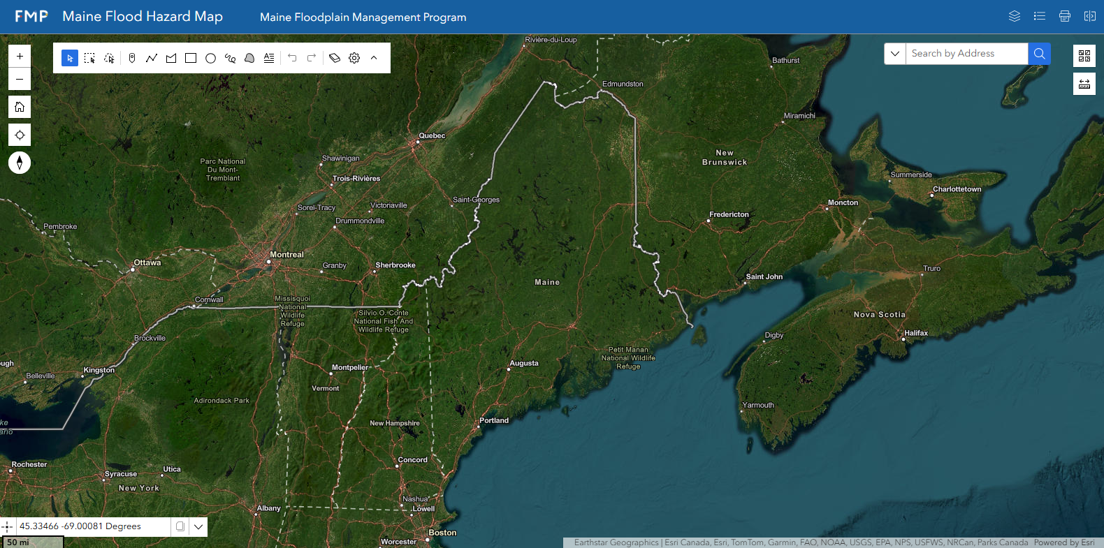
View Map Full Screen
The application contains the following GIS layers:
- National Flood Hazard Layers (NFHL) with the most current digital Flood Insurance Rate Maps (FIRM) data published by FEMA.
- Q3 Flood layer of digitized flood zones from the paper maps. Always confirm with the official FIRM maps.
- Preliminary and Pending new flood data, when available
- Elevation contour lines to compare flood elevation with ground elevation
- Address points, parcel lines, and more to help navigate and find a location
Flood Hazard Mapping for Surveyors, Engineers, and Architects
FEMA provides additional mapping data and guidance specifically for Surveyors, Engineers and Architects. These professions must have an in-depth knowledge of a few specific FEMA requirements, including the requirements for Elevation Certificates and Letters of Map Change (LOMCs). Below are resources that these professionals can use in order to incorporate flood hazard planning into their work.
- FEMA: Mapping Information Platform: Tools for professionals for map studies and mapping information.
- FEMA's Engineers, Surveyors, and Architect Resources Page: For flood risk resources for professional engineers, surveyors and architects.
- For Surveyors: The eLOMA provides a system to streamline processing of Letters of Map Amendments (LOMAs) and submit a simple Letter of Map Amendment (LOMA) request. Visit the eLOMA Registration webpage to use this online service. To learn more, read eLOMA's Brochure (PDF).
- MT-EZ LOMA: For individual property owners to request that the FEMA remove the Special Flood Hazard Area (SFHA) designation from a single structure or a legally recorded parcel of land.
- MT-1 LOMA: Package designed to assist requesters (community officials, individual property owners, and others) determine whether property is likely to be flooded during the flood event that has a 1% chance of being equaled or exceeded in any given year to remove that SFHA designation.
- MT-2 LOMA: package designed to assist requesters in gathering the data that FEMA needs to determine whether the effective NFIP map and Flood Insurance Study report for a community should be revised.
Correcting Inaccurate Community Maps
Floodplain maps can be wrong for many reasons including:
- Lack of high-resolution topographic data
- Errors made in determining base flood elevations
- Land use changes causing runoff coefficients resulting in more frequent and higher flooding levels.
- Rising sea levels
Initiating the correction of inaccurate maps is an important function of local officials. In recent years FEMA has developed national databases to track where mapping revisions are most needed. NFIP is responsible for mapping floodplains however historically resources dedicated to mapping have never kept up with mapping needs.
As a local official, you can help make this happen by attending local mapping meetings or being proactive and emailing Noah Bezanson, Acting Floodplain Management Coordinator, at Noah.Bezanson@maine.gov with any map errors. The FEMA Mapping Branch will review comments and correct them as appropriate.