DACF Home → Bureaus & Programs → Maine Natural Areas Program → Communities, Plants, and Animals → Natural Community Fact Sheets → Acidic Cliff
Printer Friendly Fact Sheet - 1.3 MB pdf (Get a free copy of Adobe Acrobat Reader)
Acidic Cliff
Scientific Name: Acidic Cliff - Gorge; State Rank: S4

- Community Description
- Soil and Site Characteristics
- Diagnostics
- Similar Types
- Conservation, Wildlife and Management Considerations
- Distribution
- Characteristic Plants
- Associated Rare Plants
- Associated Rare Animals
- Examples on Conservation Lands You Can Visit
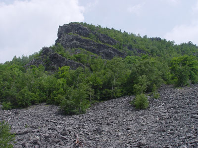
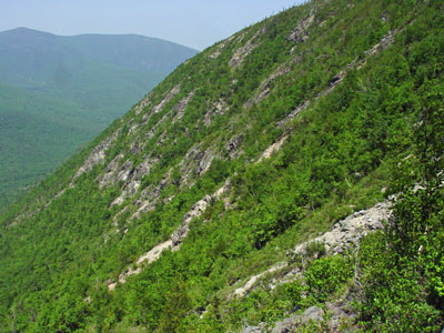
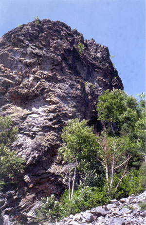
Community Description: Sparse vegetation occurs on steep outcrops or cliffs of granitic or other acidic rock. Marginal wood fern and rock polypody are characteristic ferns; fragrant wood fern can be found on cooler sites. Rock tripe lichens may form extensive patches. Back to top.

Soil and Site Characteristics: Sites occupy nearly vertical to vertical outcrops of non calcareous, erosion resistant rocks. Most are dry, with large unvegetated areas; a moist microclimate is maintained over local areas by runoff or seeps from higher elevations, or, in gorges, by the flowing streamwater. Smaller ledges and outcrops (e.g., less than 5,000 square feet of rock exposure) should be considered as inclusions in the surrounding forest rather than distinct natural communities. Back to top.
Diagnostics: Sparsely vegetated cliffs occur below treeline, without circumneutral indicator species. Back to top.
Similar Types: Circumneutral Outcrops have circumneutral indicator species such as shrubby cinquefoil or certain uncommon herbs. Low Elevation Balds are on summits, not cliffs, and usually have heath shrubs mixed with the herbs. Back to top.
Conservation, Wildlife and Management Considerations: Many sites are relatively inaccessible and minimally affected by either forestry or recreational activities. Several are within public lands or conservation ownership.
Common ravens, peregrine falcons, and golden eagles may nest on cliffs in western, northern and coastal Maine. Back to top.
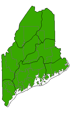
Distribution: Essentially statewide except for extreme southern Maine, more common northward. Landscape Pattern: Small Patch. The minimum mapping unit is 5,000 square feet of rock exposure; smaller ledges and outcrops should be considered as inclusions in the surrounding forest rather than distinct natural communities. Back to top.


Characteristic Plants: These plants are frequently found in this community type. Those with an asterisk are often diagnostic of this community.
- Herb
- Brownish sedge
- Common hairgrass
- Marginal woodfern
- Rand's goldenrod
- Rock polypody
- Bryoid
- Rocktripe lichen
- Golden eagle
- Peregrine falcon
Examples on Conservation Lands You Can Visit
| Example | County |
|---|---|
| Deboullie Ponds Public Lands | Aroostook Co. |
| Dunn Falls, Appalachian Trail | Oxford Co. |
| Grindstone Falls | Penobscot Co. |
| Mount Kineo Public Lands | Piscataquis Co. |
| Tunk Mountain, Donnell Pond Public Lands | Hancock Co. |
