DACF Home → Bureaus & Programs → Maine Geological Survey → Maps, Publications and Online Data → Using Geologic Maps → Surficial Materials Maps
Surficial Materials Maps Description

Read the map sidebar (pdf)
Read the map explanation (pdf)
Tips for reading maps
Online maps
Digital data
What are surficial materials?
Geologic processes such as weathering and erosion break bedrock down into smaller particles of sediment. Sediments such as clay, silt, sand, gravel, and other loose deposits which lie on top of bedrock are grouped together in the general category of "surficial materials." These materials are not soils; they are the deeper earth materials that lie between the soil zone and the underlying bedrock. Soils commonly develop by weathering of the uppermost part of these materials. The map sidebar (pdf) contains additional information describing surficial materials.
Surficial Materials Maps
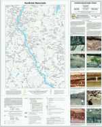
Surficial Materials Maps show the textures of surficial sediments, independent of interpretations regarding their origin. Thicknesses of gravel, sand, silt, clay, and diamicton are shown. Data comes from auger holes, test pits, well logs, test borings, and gravel pits. For more information, read the map explanation (pdf) or link to our tips for reading materials maps.
Uses of surficial materials information
Materials data may be used for a variety of purposes by landowners, planners, teachers, or anyone else wanting to know what lies beneath the land surface. For example, it may aid in the search for economically important deposits such as sand and gravel for aggregate or clay for bricks or pottery. Environmental issues such as the location of a suitable landfill site or the possible spread of contaminants are directly related to surficial materials information. Construction projects such as locating new roads, excavating foundations and utility lines, or siting new homes are also important uses of materials data.
How to obtain or view these maps
Use the Maps and Publications Search to identify printed and online publications available from the Maine Geological Survey. You can search for maps and publications by geographic area or subject. Search results are linked to online publications. To order printed materials see the ordering instructions.
Use our online materials map list to link directly to the quadrangle of your choice.
Last updated on July 15, 2015