DACF Home → Bureaus & Programs → Maine Natural Areas Program → Ecological Reserves → Wassataquoik Stream
(Printer Friendly Version-57 KB pdf) (Download a free copy of Adobe Acrobat Reader)
Wassataquoik Stream
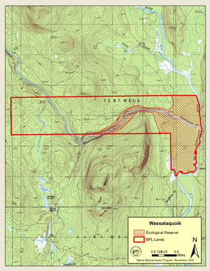
T3 R7 WELS

Vital Statistics
- Size: 2,110 acres
- Regulated: 0 acres
- Non-Regulated: 2,110 acres
- Upland: 1,635 acres
- Forested Wetland (NWI): 418 acres
- Non-Forested Wetland: 16 acres
- Open Water: 40 acres
- Roads: unimproved < 1 mile
- Biophysical Region: Central Mountains/Aroostook Highlands
- BPL Region: North

(Download a Printer Friendly Version-645 KB pdf-of this map.)
Exemplary Natural Communities
Rare Plants
| Scientific Name | Common Name | State Status | State Rank | Global Rank |
|---|---|---|---|---|
| Panax quinquefolius | American Ginseng | Endangered | S3 | G3G4 |
Rare Animals
There are no documented occurrences of rare animals within this Ecoreserve. For more information on rare animals in Maine, visit the Maine Department of Inland Fisheries and Wildlife.
Description
The Wassataquoik Stream ecological reserve lies at the confluence of Wassataquoik Stream and the East Branch of the Penobscot River. The central features are stream bank and river floodplain forests. The steep wooded slopes of Wassataquoik Stream give way it its mouth to a broad floodplain, and the vegetational gradients reflect the effects of topography, hydrology and soils.

The mixed forests along Wassataquoik Stream rise 15 - 35 meters above the streambed. Both sides of the stream contain scattered older trees, mostly white pine, among a multi-aged mix of hardwood and softwood. On the north bank, large superstory white pine (over 19 m tall and over 90 cm dbh) emerge over the canopy of hemlock, spruce, pine, and poplar. The south bank lacks these superstory pines but has some large hemlock, sugar maple, popular and spruce, with some trees over 100 years old. The stumps and traces of logging roads throughout this area are evidence of its past logging history.

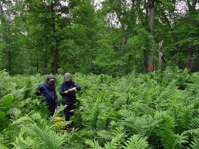
The floodplain of the East Brach, on either side of the Wassataquoik's mouth, is a fine example of a relatively undisturbed hardwood floodplain forest. It is large, over a mile in length, and displays excellent gradations from the river's edge to the uplands back up towards Hunt Mountain. At the lower elevations near the stream, impressive silver maple (some over 120 cm dbh) form an arching canopy over a carpet of tall ferns and other herbs. Large fallen trees have left canopy gaps, with green ash, young silver maple, and elm regenerating. As one moves away from the river, the gradual change in elevation leads to replacement of the silver maple by sugar maple, and a change in the herb flora composition as well. It is unusual to find terrace floodplain forests like this as intact as seen here.