DACF Home → Bureaus & Programs → Maine Natural Areas Program → Communities, Plants, and Animals → Natural Community Fact Sheets → Alder Floodplain
Printer Friendly Fact Sheet - 1 MB pdf (Get a free copy of Adobe Acrobat Reader)
Alder Floodplain
Scientific Name: Alder Floodplain; State Rank: S4
This is a new community type in Maine, differentiated from Alder Thicket.

- Community Description
- Soil and Site Characteristics
- Diagnostics
- Similar Types
- Conservation, Wildlife and Management Considerations
- Distribution
- Characteristic Plants
- Associated Rare Plants
- Associated Rare Animals
- Examples on Conservation Lands You Can Visit
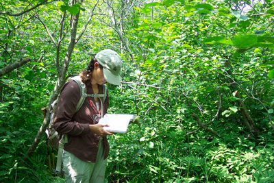
Community Description: These shrub dominated wetlands are characterized by speckled alder (or less commonly, mountain alder or smooth alder) and an assemblage of grasses and herbs indicative of alluvial conditions. Red maple, American elm, and red-osier dogwood may be co-dominant with alders, but other woody species are usually sparse in these moderate to high energy settings. Early in the season woody species may show signs of ice scour. Bluejoint grass is common, and frequent herbs include Virgin's bower, ostrich fern, flat-topped white aster, royal fern, sensitive fern, boneset, swamp dewberry, tall meadow-rue, and woodland horsetail. Back to top.
Soil and Site Characteristics: This type occurs along medium to large moderate to high energy riverbanks that are seasonally flooded and subject to ice scour. It is usually on mineral soil. Back to top.
Diagnostics: These are shrub-dominated floodplains along medium to large rivers. Alders dominate and comprise >30% cover. Heath shrubs and peat are sparse or absent. Back to top.
Similar Types: Rivershore Shrub Thickets occur in similar floodplain settings in northern Maine, but alder is not dominant. Alder Thickets typically occur in stagnant basins on deeper organic (muck or peat) soils, with peat mosses frequent. Back to top.
Conservation, Wildlife and Management Considerations: The rivershore habitat of this natural community suggests that direct threats from development are relatively low though excessive watershed development would likely increase the volume and intensity of runoff and potentially alter riverine structure and community composition. Additionally, hydrologic alteration (i.e., impoundments) would compromise the disturbance regime, but new dams are unlikely on medium and large rivers.
These shrublands, especially when they occur in close proximity to open water may, provide habitat for common bird species such as common yellowthroat, alder flycatcher, Wilson's warbler, and Lincoln's sparrow. Some occurrences of this community type support vernal pools, which are important breeding habitat for a variety of amphibians including wood frogs, spotted salamanders, and blue-spotted salamanders. In southern Maine, Blanding's and spotted turtles may feed on amphibian larvae and egg masses present in such pools. Wood turtles bask and forage in shrubby floodplains of moderate to large rivers statewide. Back to top.
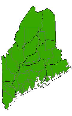
Distribution: Statewide; extending in all directions from Maine. Landscape Pattern: Small to Large Patch. Back to top.


Characteristic Plants: These plants are frequently found in this community type. Those with an asterisk are often diagnostic of this community.
- Sapling/Shrub
- Arrow-wood
- Meadowsweet
- Red maple*
- Red osier dogwood
- Speckled alder*
- Herb
- Bluejoint*
- Boneset
- False nettle
- Flat-topped white aster*
- Lady fern
- Ostrich fern
- Royal fern
- Sensitive fern*
- Swamp dewberry*
- Tall meadow-rue*
- Virgin's bower*
- Wild calla
- Woodland horsetail
- Blue-spotted salamander
- Wood turtle
Examples on Conservation Lands You Can Visit
| Example | County |
|---|---|
| Moose River, Holeb Public Lands | Somerset Co. |
| Narraguagus Wildlife Management Unit | Washington Co. |
| St. John River | Aroostook Co. |