DACF Home → Bureaus & Programs → Maine Geological Survey → Maps, Publications and Online Data → Using Geologic Maps → Coastal Landslide Hazards Maps
Coastal Landslide Hazards 1:24,000-scale Maps Description

Read the map sidebar (pdf).
Read the map explanation (pdf).
Tips for reading maps
Online maps
Digital data
What are coastal landslide hazards?
Sea level is gradually rising along the coast of Maine. This rise in the ocean allows waves to erode beaches and flats at the base of coastal bluffs. Over time, erosion removes material from the base of a coastal bluff and steepens the face of the bluff. Sediments at the base of the bluff stabilize it, and when they are removed, the bluff is no longer in equilibrium. Only the strength of the material within the bluff holds the bluff in place. Continued erosion or lubrication of the bluff materials by ground water may overcome this internal resistance, particularly in clay bluffs, and result in a landslide. The map sidebar (pdf) contains additional information describing coastal landslide hazards.
Coastal Landslide Hazards Maps
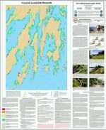
Coastal Landslide Hazards Maps show locations of known landslides and areas of potential landslide hazard on bluffs along the Maine coast. The explanation describes factors influencing landslide risk. For more information, read the map explanation (pdf) or link to our tips for reading landslide hazard maps.
Uses of coastal landslide hazard information
This map provides an introduction to understanding landslide risk and guidance on what steps to take if the risk of a landslide is a concern in a particular coastal area. Landslides can occur in high coastal bluffs composed of muddy sediment. This landslide hazards map describes the internal stability of sediment bluffs.
How to obtain or view these maps
Use the Maps and Publications Search to identify printed and online publications available from the Maine Geological Survey. You can search for maps and publications by geographic area or subject. Search results are linked to online publications. To order printed materials see the ordering instructions.
Use our online landslide hazard map list to link directly to the quadrangle of your choice.
Last updated on July 15, 2015