DACF Home → Bureaus & Programs → Maine Geological Survey → Maps, Publications and Online Data → Using Geologic Maps → National Wetlands Inventory Maps
National Wetlands Inventory Maps
What is the National Wetlands Inventory?
The National Wetlands Inventory (NWI) provides information on the characteristics, extent, and status of the Nation's wetlands and deepwater habitats and other wildlife habitats. The inventory is conducted by the U.S. Fish and Wildlife Service.
National Wetlands Inventory Maps
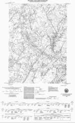
This series of maps, produced by the U.S. Fish and Wildlife Service and distributed by the Maine Geological Survey, identifies and classifies wetlands in Maine.
Uses of wetlands information
To protect wetlands, you must know what kinds of wetlands you have, where they are, and what is happening to them, i.e., their currrent status and the trends of losses or gains. Wetlands are mapped to show their current status, and updated or sampled to show their trends of losses or gains. Once wetlands are mapped, many types of wetland assessment can be performed. Wetland assessment is used for many activities: monitoring wetland health, making permit decisions, targeting voluntary wetland restoration activities, maintaining biodiversity, restoring species, measuring mitigation success, undertaking watershed management, developing wetland classifications, protecting public water supplies, implementing local land use plans and so on.
How to obtain or view these maps
Use the Maps and Publications Search to identify printed and online publications available from the Maine Geological Survey. You can search for maps and publications by geographic area or subject. Search results are linked to online publications. To order printed materials see the ordering instructions.
Last updated on July 15, 2015
