April 26, 2017 at 4:45 pm
By Regional Wildlife Biologist Mark A. Caron
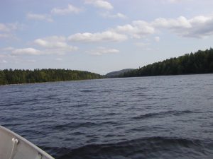
 In addition to overseeing Wildlife Management Areas (WMAs), the Management Section of the Wildlife Division also oversees other lands owned either in fee or that are included as Conservation Easements. Spednic Lake is one such location where both lands owned in fee and conservation easement s are in place. Several acquisition efforts over the last 25 years have resulted in the creation of the Booming Ground WMA (650 acres), 16 miles of shoreline held in fee, and an additional 14.4 miles of shoreline held in a conservation easement. The shoreline conservation efforts are 500 feet deep and are intended to restrict future development. As part of these conservation efforts, MDIFW has also acquired 12 islands in Spednic Lake. Several other conservation efforts have further protected the St. Croix River below the Vanceboro Dam and are managed by the Maine Department of Agriculture, Conservation, & Forestry (DACF). The St. Croix Watershed borders with New Brunswick and they have also conserved vast acreages associated with the river and lake.
[caption id="attachment_2279" align="alignright" width="300"]
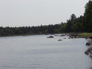
 The shore near the western boundary[/caption]
In October 2012, the Spednic Lake/Upper St. Croix River Management Plan was completed. The document constitutes a 15-year Management Plan for 4,300 acres and 69 miles of shoreland on Spednic Lake and the Upper St. Croix River. The Plan summarizes the planning process and regional context, but primarily it is to 1) provide a description of the resources found on the properties, 2) identify the management issues identified by members of the public and agency staff, 3) and put forth management recommendations to be implemented over the next 15-year period.
Spednic Lake is one of the largest lakes in Maine and as stated is largely undeveloped. The lake and associated shoreline, wetland and upland areas provide a variety of recreational opportunities including fishing, hunting, boating/canoeing, camping, and nature watching. There are five campsites located on the lake that are included within the Department’s oversight; four along the shoreline and one located on Birch Island. Campsites are maintained via an agreement with the St. Croix Waterway Commission. Water access to Spednic Lake is located at three sites. The boat launch in Vanceboro located at the dam and border crossing (Delorme Atlas map 46 [C-3]), the Forest City landing at the base of the arm between Mud Lake and Spednic Lake, and the Castle Road landing located at the top of Spruce Mountain Cove (both Delorme Atlas map 45 [B-5].
MDIFW Campsites - Spednic Lake
 In addition to overseeing Wildlife Management Areas (WMAs), the Management Section of the Wildlife Division also oversees other lands owned either in fee or that are included as Conservation Easements. Spednic Lake is one such location where both lands owned in fee and conservation easement s are in place. Several acquisition efforts over the last 25 years have resulted in the creation of the Booming Ground WMA (650 acres), 16 miles of shoreline held in fee, and an additional 14.4 miles of shoreline held in a conservation easement. The shoreline conservation efforts are 500 feet deep and are intended to restrict future development. As part of these conservation efforts, MDIFW has also acquired 12 islands in Spednic Lake. Several other conservation efforts have further protected the St. Croix River below the Vanceboro Dam and are managed by the Maine Department of Agriculture, Conservation, & Forestry (DACF). The St. Croix Watershed borders with New Brunswick and they have also conserved vast acreages associated with the river and lake.
[caption id="attachment_2279" align="alignright" width="300"]
 The shore near the western boundary[/caption]
In October 2012, the Spednic Lake/Upper St. Croix River Management Plan was completed. The document constitutes a 15-year Management Plan for 4,300 acres and 69 miles of shoreland on Spednic Lake and the Upper St. Croix River. The Plan summarizes the planning process and regional context, but primarily it is to 1) provide a description of the resources found on the properties, 2) identify the management issues identified by members of the public and agency staff, 3) and put forth management recommendations to be implemented over the next 15-year period.
Spednic Lake is one of the largest lakes in Maine and as stated is largely undeveloped. The lake and associated shoreline, wetland and upland areas provide a variety of recreational opportunities including fishing, hunting, boating/canoeing, camping, and nature watching. There are five campsites located on the lake that are included within the Department’s oversight; four along the shoreline and one located on Birch Island. Campsites are maintained via an agreement with the St. Croix Waterway Commission. Water access to Spednic Lake is located at three sites. The boat launch in Vanceboro located at the dam and border crossing (Delorme Atlas map 46 [C-3]), the Forest City landing at the base of the arm between Mud Lake and Spednic Lake, and the Castle Road landing located at the top of Spruce Mountain Cove (both Delorme Atlas map 45 [B-5].
MDIFW Campsites - Spednic Lake
Categories