DACF Home → Bureaus & Programs → Municipal Planning Assistance Program → Case Studies → Coastal Community Planning Grant Case Studies
Coastal Community Grant Case Studies
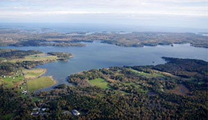
St. Georges River Estuary
Coastal Community Grants are an important element of the Municipal Planning Assistance Program’s mission to improve economic conditions by providing technical and financial assistance to Maine municipalities. The Coastal Community Grants are awarded and administered by the Maine Department of Agriculture, Conservation and Forestry Municipal Planning Assistance Program. The Maine Coastal Program, Department of Marine Resources, provides funding through Maine’s federal coastal zone management award from the National Oceanographic and Atmospheric Administration (NOAA).
This is a competitive grant program for projects designed to improve water quality, increase adaptation to erosion and flooding, restore coastal habitat, promote sustainable development, and enhance the coastal-dependent economy while preserving coastal natural resources within Maine’s coastal zone.
Coastal Community Grant Awards
- Coastal Community Planning Grant Projects - A listing of grants awarded with their primary issue area, completion date and grant amount.
Coastal Community Grant Awards by Location & Project Type
The color coded maps below show awards by location and the project type. Click the thumbnails to view larger maps.
Case Studies
At the conclusion of each project, grant recipients are requested to prepare a case study to describe the project’s approach and results, identify next steps and needs, share lessons learned and applicability for other municipalities and provide recommendations to the MCP for follow-up by state agencies to address identified municipal and regional needs and emerging coastal issues.
Coastal Community Planning Grant projects are designed to address the goals of the Maine Coastal Program. The case studies appear under the primary goal the project seeks to address.
Ensuring Sustainable, Vibrant Coastal Communities
- Gardiner Downtown Plan (#74)
- Southern Maine Planning & Development Commission Towns of Kittery, Eliot, South Berwick and York Stormwater Utility Feasibility Workshop (#17)
- Hancock County Planning Commission Village and Waterfront Plan for the Town of Orland (#45)
- Bar Harbor Conservation Commission Open Space Plan (#9)
Improving Coastal Public Access
- Town of Cutler Public Access Project (#8)
- Wells Harbor Pedestrian Bridge Study (#15)
- Passy Rail Trail Project (#20)
- River to Harbor Walk (Megunticook River) (#21)
- Reconnecting Yarmouth Village to the Working Waterfront (#22)
- Cutler Harbor Public Access Project (Part II) (#42)
- City of Belfast Rangeway Management Plan (#43)
- Belfast Rangeways: Creating Development and Management Plans for the Long-Term Preservation of Public Access to the Shore
- Town of Wells Marsh Walk Project
Addressing Effects of Land Use Activity on Water Quality
- Southern Maine Planning and Development Commission Tech standards for sediment and erosion control plans (#75)
- Waldoboro Septic Sytem Vulnerability Analysis (#76)
- Mare Brook Watershed Assessment and Community Engagement Project (#46)
- Addressing Land Use on Water Quality in the Ogunquit River Watershed (#47)
- Watershed Approach to Managing Land Use Impacts to Coastal Waters (#48)
- Washington County Council of Governments Rain Gauges and Shellfish Closure Outreach (#49)
- Southern Maine Planning and Development Commission York River Watershed Build-out Analysis (#61)
- Town of Falmouth Route 1 Commercial District Stormwater Management Plan (#10)
- City of Portland Stormwater Outreach & Sewer Rate Change Project (#11)
- Bangor Stormwater Pollution Stormwater Pollution Prevention (P2) & Volunteer Outreach and Engagement Initiative (#12)
- City of Bath Downtown Stormwater Management Study (#50)
- Town of Cape Elizabeth Town Center Stormwater Management Plan (#51)
- City of Gardiner Downtown Stormwater Management Study (#53)
- Town of Georgetown - KELT Clean Water for Clams: Citizen Science Water Quality Project (#13)
- Southern Maine Planning & Development Commission South Berwick Open Space Conservation Plan (#16)
- Hancock County Planning Commission Blue Hill Bay Watershed Needs Assessment (#18)
- Water Quality Remediation for Laite Beach and Camden Harbor (#23)
- Kittery Septic System Mapping and Watershed Protection Project (#24)
- Georges River Tidewater Association St. George Estuary Water Quality Monitoring Program (#25)
- Ellsworth Stormwater Management & Adaptation Plan (#52)
- Greater Portland Council of Governments Proactive Watershed Management in Falmouth (#63)
- Hancock County Planning Commission Eastern Bay Watershed Management Plan (#64)
- Washington County: Coast-wide Shoreland Zoning GIS model update (#68)
- City of Ellsworth: Stormwater Management and Adaptation
Planning - Southern Maine Planning and Development Commission
York River Watershed Build-out Analysis - Gardiner Stormwater Management Study
Restoring Coastal Habitats
- Town of Brunswick Community Project to Remove invasive European Green Crabs from two coves (#19)
- Town of Arrowsic Alewife Restoration and Wildlife Crossing (#1)
- Citizen Science and Engineering to plan for the restoration of Pemaquid River Alewife (#27)
- Citizen Science and Engineering to Improve Fish Passage at Center Pond (#28)
- MidCoast Council of Governments - KELT Improving Water Quality of Shellfish Growing Areas (#2)
- Little River Fish Passage Barrier Survey (#3)
- Town of Warren ‘Stream Smart’ Culvert Replacement Initiative (#30)
- Washington County Council of Governments Downeast Sustainability Project River Herring Restoration (#31)
- Town of Woolwich Nequasset Fishway Restoration Planning (#4)
- Town of Boothbay Harbor West Harbor Pond Water Quality Restoration (#56)
- Town of Cape Elizabeth Culvert and Habitat Assessment (#57)
- Town of Harpswell A Plan for Basin Point Road and its wetlands (#58)
- City of South Portland Trout Brook Culvert Improvements (#59)
- Town of Woolwich - KELT Nequasset Fishway Restoration (#5)
- City of Augusta Final Design for the restoration of a historical Alewife Run of Significance to the Lower Kennebec
- Town of Boothbay Harbor - West Harbor Pond Water Quality Restoration
- Washington County Council of Governments - Downeast Sustainability River Herring Restoration Project
- Cape Elizabeth Culvert and Habitat Assessment
- South Portland Trout Brook Culvert Improvements
Preparing for Coastal Storms, Erosion and Flooding
- Southern Maine Planning & Development Commission Town of York Sea Level Rise Chapter in Comprehensive Plan (#14)
- Machias Waterfront Resilience and Renewal (#60)
- WCCOG Washington County Resilience (#67)
- Southern Maine Planning & Development Commision - Tides, Taxes and New Tactics (#71)
- Phippsburg - KELT Collaboration to increase resiliency (#72)
- Southern Maine Planning & Development Commission - Model Coastal Resilience Ordinance (#73)
- Southern Maine Planning & Development Commission - TA Vinalhaven Flood Resilience Checklist
- Washington County Council of Governments TA Culvert Bond Implementation
- Southern Maine Planning & Development Commission Town of York Comprehensive Plan SLR Chapter (#14)
- Town of Chebeague Island Sea Level Rise Vulnerability Study (#32)
- Town of Chebeague Island Coastal Hazards and Adaptation Study (#32)
- Hancock County Planning Commission Adapting Working Waterfront: Implementation Strategy for Resiliency (#33)
- Town of Islesboro Resilience Planning for Flooding from Storm Surge & SLR (#34)
- Lincoln County Regional Planning Commission Coastal Hazards Resiliency Tools (#35)
- Lincoln County Regional Planning Commission FEMA FIRM map/SLR ordinance provision outreach (#37)
- Lincoln County Regional Planning Commission Coastal Hazards Resiliency Tools (#38)
- Lincoln County Regional Planning Commission Downtown Boothbay Harbor Adaptation Options for Increased Storm Surge Resiliency (#39)
- Town of Vinalhaven Coastal Flooding Vulnerability Study of Downstreet Business District (#40)
- Town of Wiscasset Waste Water Treatment Plant Coastal Hazard Resilience (#41)
- Town of Machias Waterfront Resilience and Renewal (#60)
- Town of Damariscotta Downtown Damariscotta Coastal Hazards Preliminary Engineering Study (#6)
- Lincoln County Regional Planning Commission Sea Level Rise Coastal Hazards Study (#7)
- Town of Warren ‘Stream Smart’ Culvert Replacement Initiative (#30)
- Town of Bowdoinham Public Works Waterfront Property Redevelopment (#62)
- City of South Portland Vulnerability Assessment Mapping Project (#65)
- Town of Stonington Municipal Infrastructure Vulnerability Assessment and Adaptation Plan (#66)
- Washington County Council of Governments Resiliency Project (#67)
- Lincoln County Regional Planning Commission -
FEMA FIRM map/SLR Ordinance Provision Outreach - Lincoln County Regional Planning Commission
Sea Level Rise Ordinance Project - Town of Vinalhaven: Coastal Flooding - Vulnerability Study of the Downstreet Business District
- Machias Waterfront Resilience and Renewal
- Harpswell Plan for Basin Point Road and its Wetlands
- Bustins Island Village Corporation: Green Infrastructure Design (#68)
- Town of Camden: Camden Harbor Park Seawall and
Montgomery Dam Redesign (#69) - Monhegan Plantation: Alternative Water Supply
Feasibility Study (#70) - Greater Portland Council of Governments:
Community Intertidal Data Portal (#77) - Town of Topsham: Nature Based Climate Solutions for the Topsham Fair Mall Stream Watershed (#78)
- Town of Vinalhaven: Preliminary Roadway and Culvert
Assessment to Mitigate Coastal Flooding (#79) - Southern Maine Planning and Development Commission: Development of Model Ordinances for Erosion and Sediment Control Plans and Low Impact Development Strategies for Southern Maine MS4 Coastal Communities (#80)